CompassRead magnetic north
THE PLANET, IN BETTER PROPORTION
EQUAL EARTH:
Maps & Satellite
for Everyone
One app for fairer world maps, everyday place discovery, access insights, satellite imagery, and practical geospatial tools.
Available now on iPhone and Android · One-time app purchase
MAP PROJECTIONSPLACE DISCOVERYACCESSEARTH OBSERVATIONFIELD TOOLS
WHY EQUAL EARTH
Equality starts with how we see the world.
EQUAL EARTH turns geographic information into something people can explore, compare, and use—without requiring professional GIS experience.
From map projection literacy to nearby essentials and satellite views, every feature is designed to build a more informed appreciation of our shared planet.
01 / EQUAL EARTH
TRUE PROPORTION
See size before assumption.
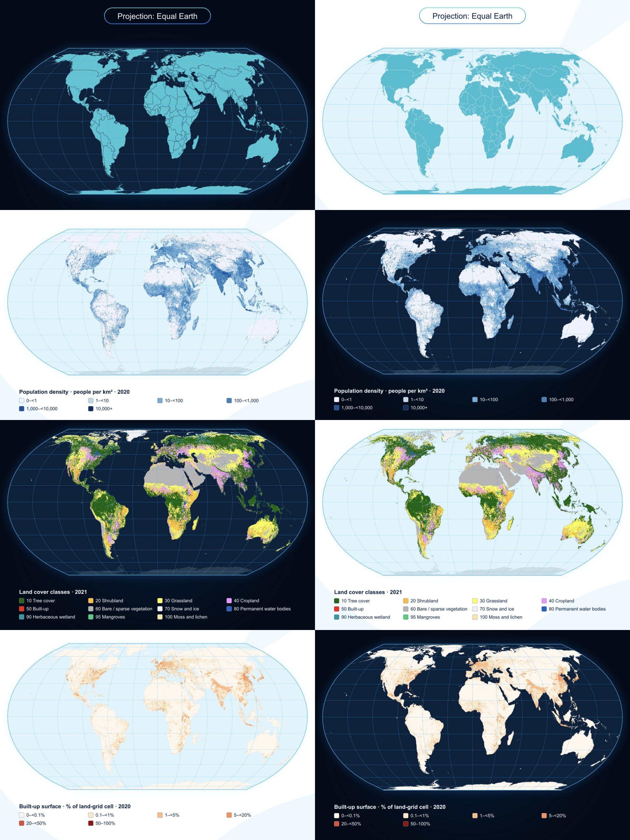
Start with the Equal Earth projection, then compare it directly with Mercator and layered overlays. Zoom, pan, isolate countries, compare actual areas, test latitude distortion, and learn through quick geography quizzes.
- Equal Earth, Mercator, and dual-overlay viewers
- Country and continent area comparisons
- At My Latitude distortion explorer
- Educational references and exportable map posters
Equal Earth is an equal-area pseudocylindrical projection designed to keep regions correctly proportioned in area. About the projection ↗
02 / EQUAL EXPLORE
PLACES IN CONTEXT
Search, move, and understand where you are.
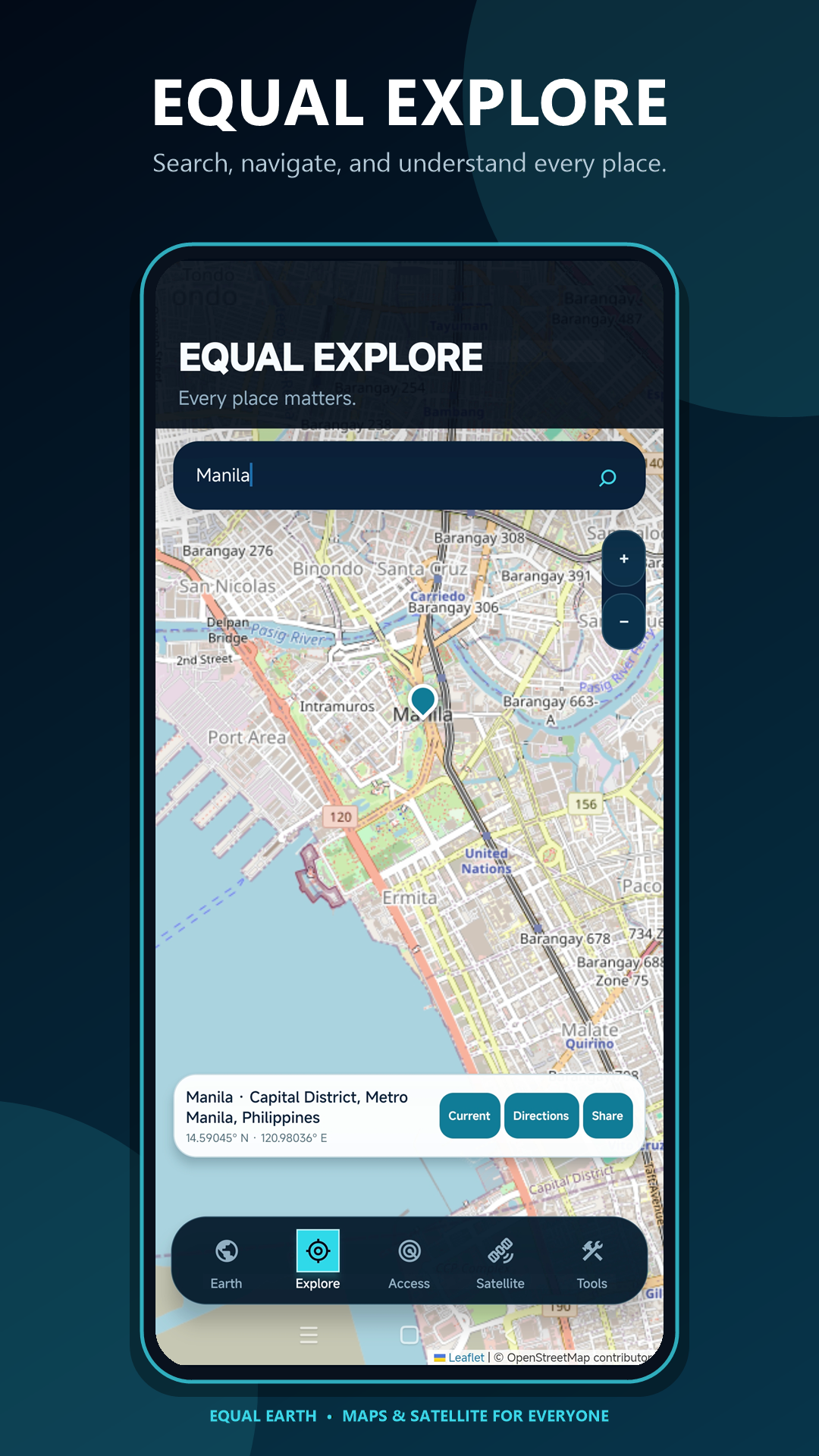
Explore cities, landmarks, coordinates, and destinations through a fluid map interface. Tap any location for its place name and coordinates, return to live GPS, save a place, or compare driving and walking routes without leaving the app.
LiveGPS position
2 modesDriving + walking
On-mapSearch + directions
MAP YOUR PLACE
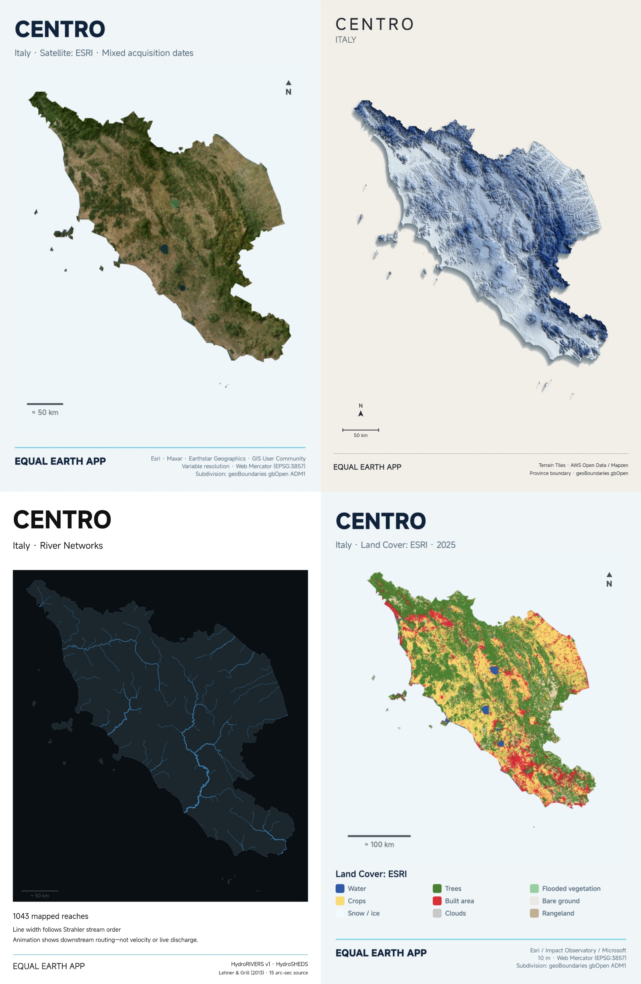
Create your own thematic maps for your country, province, or state.
Turn geographic data into presentation-ready satellite, 3D relief, river-network, land-cover, population, and other thematic map posters.
03 / EQUAL ACCESS
WHAT IS WITHIN REACH?
Turn nearby places into a picture of everyday access.
Keep the map centered on your current location, choose a search radius, and discover useful places through open geographic data. Results are grouped for quick scanning and cached for faster repeat exploration.
☕FoodCafés, groceries, markets
✚HealthHospitals, clinics, pharmacies
↗MobilityStops and transport access
♧ParksGreen and open spaces
⌖Other NearbySchools, banks, services
Nearby discovery uses © OpenStreetMap contributors data under the ODbL.
04 / EQUAL SATELLITE
EARTH OBSERVATION, MADE APPROACHABLE
See what ordinary maps cannot show.
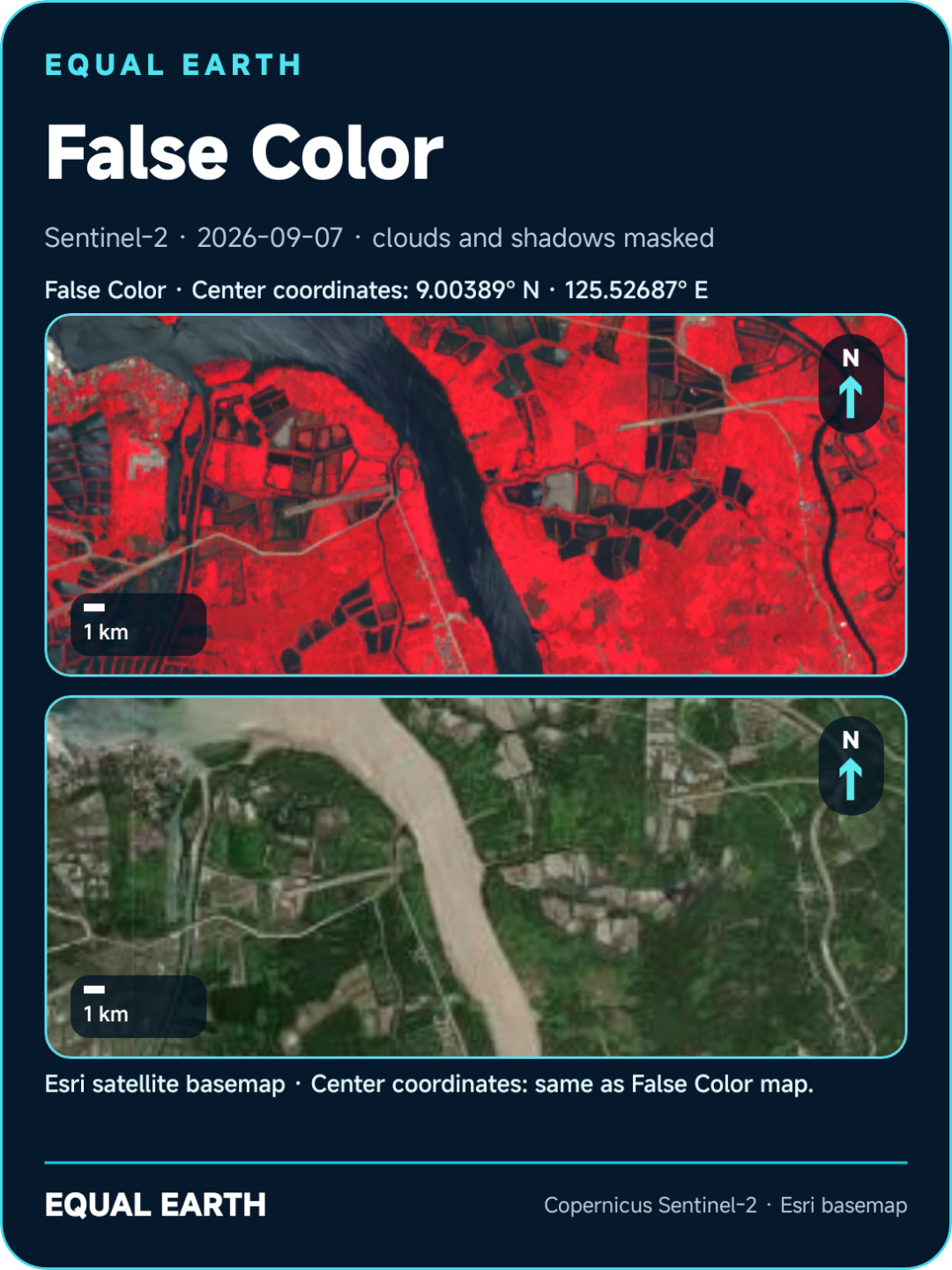
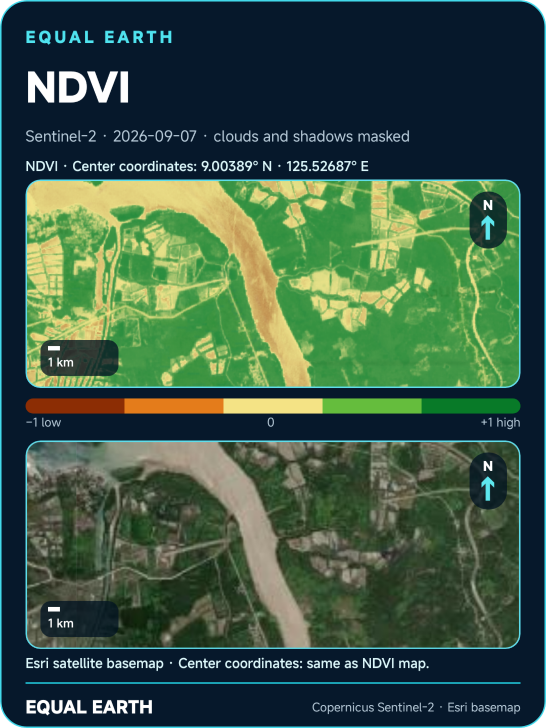
Move from an Esri satellite basemap to recent Copernicus Sentinel‑2 scenes. Explore natural color, false color, vegetation, and water views—then export polished map posters with scale, north arrow, date, legend, and center coordinates.
RGBFalse ColorNDVIMNDWI
Sentinel‑2’s multispectral instrument includes four 10 m bands, six 20 m bands, and three 60 m bands. Copernicus documentation ↗
05 / EQUAL TOOLS
YOUR POCKET GEOSPATIAL KIT
Useful instruments, without the GIS learning curve.
Measure, document, navigate, and save what matters. Each tool connects location to an action—helping learners, travelers, field teams, and curious explorers observe Earth more carefully.
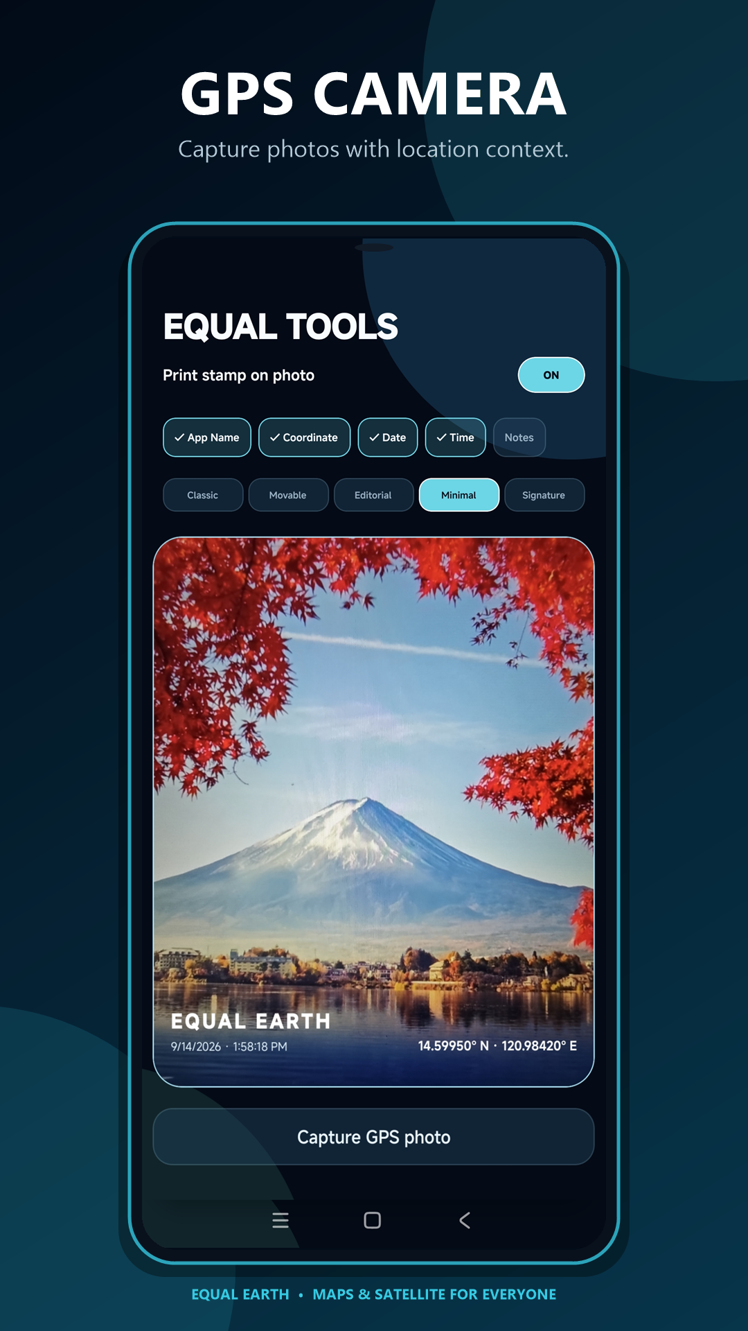
GPS CameraStamp location on photos
AltitudeUnderstand elevation
SpeedometerTrack movement speed
CoordinatesRead and copy a GPS fix
Saved PlacesKeep locations organized
Measure AreaTrace surface extent
Measure DistanceMeasure a route or span
Share LocationSend where you are
Export MapsSave shareable geography
SIMPLE OWNERSHIP
One planet.
One purchase.
No recurring subscription for the app. Pay once before download and keep Equal Earth as your everyday map and Earth-observation companion.
ONE-TIME APP PURCHASE₱99Pay once · Download once · Keep exploring
Available now for Android and iPhone.
OPEN DATA, CLEAR CREDIT