Most of us now experience the world through a screen in our hands. We search for places, navigate cities, check satellite images, discover nearby locations, take geotagged photos, and learn about countries we may never have visited.
But how often do we stop and ask a more basic question: Is the world map we are looking at actually showing countries in their correct relative sizes?
This is where the Equal Earth map projection offers a different perspective.
Learning about Equal Earth no longer has to happen only inside a geography textbook, GIS laboratory, or desktop mapping program. With EQUAL EARTH: Maps & Satellite by LINYA Labs, you can explore map projections, create maps, view satellite imagery, and use practical geospatial tools directly from your phone.
01
What Is the Equal Earth Map Projection?
Every flat world map has to transform the curved surface of Earth into a two-dimensional image. That transformation always involves compromises.
Some map projections preserve direction. Others are designed to preserve shape locally, distance from particular locations, or geographic area. The Equal Earth projection belongs to the last group.
It is an equal-area world map projection, which means countries and continents retain their correct relative areas on the map. This matters because the way a world map is projected can significantly affect how large or small different parts of the planet appear.
02
Equal Earth vs Mercator
The Mercator projection remains one of the world's most recognizable map projections. It is extremely useful for certain purposes, particularly because it preserves local angles and directions. But when it is used to show the entire world, the size of areas becomes increasingly exaggerated toward the poles.
This is why high-latitude places can appear much larger than their actual area would suggest. Equal Earth takes a different approach. Instead of preserving those local angles, it prioritizes relative area.
This makes it particularly useful when we want to understand questions such as:
- How large is one country compared with another?
- How much of Earth is covered by a particular land-cover type?
- How should population, forests, agriculture, climate, or environmental patterns be represented across the world?
- What does the planet look like when countries retain their correct relative area?
Different projections are designed for different purposes. Understanding those trade-offs is one of the central lessons behind EQUAL EARTH.
03
Why Learn Equal Earth on a Phone?
Geography education has traditionally depended heavily on wall maps, atlases, textbooks, and desktop GIS software. Those remain valuable. But today, the device that most people have with them almost all the time is their smartphone.
Instead of seeing map projections only as static illustrations in a book, learners can interact with them directly. You can zoom, compare, select countries, examine their actual areas, and move between world maps, local maps, satellite images, and your own GPS location.
Maps & Satellite for Everyone.
The goal is to make maps, Earth observation, and practical geospatial information easier to explore even if you do not have professional GIS experience.
Compare Equal Earth and Mercator Directly
One of the best ways to understand map projections is not simply to read their definitions. It is to compare them visually.
Inside EQUAL EARTH, you can explore the Equal Earth and Mercator projections and examine how countries and continents change between the two views. Instead of merely being told that Mercator enlarges high-latitude areas, you can see the difference yourself.
- Equal Earth and Mercator world maps
- Projection overlays
- Country and continent area comparisons
- Distortion by latitude
- Geographic stories and quizzes
This makes the phone itself a small interactive geography laboratory.
Your Location Can Help Explain Map Distortion
Map projections become even more interesting when they connect to a place you already know: your own location.
EQUAL EARTH includes tools for exploring distortion by latitude. The effect of Mercator area distortion increases as you move farther from the equator. Instead of thinking about this only mathematically, a learner can begin with a familiar question: What does map distortion look like at my latitude?
04
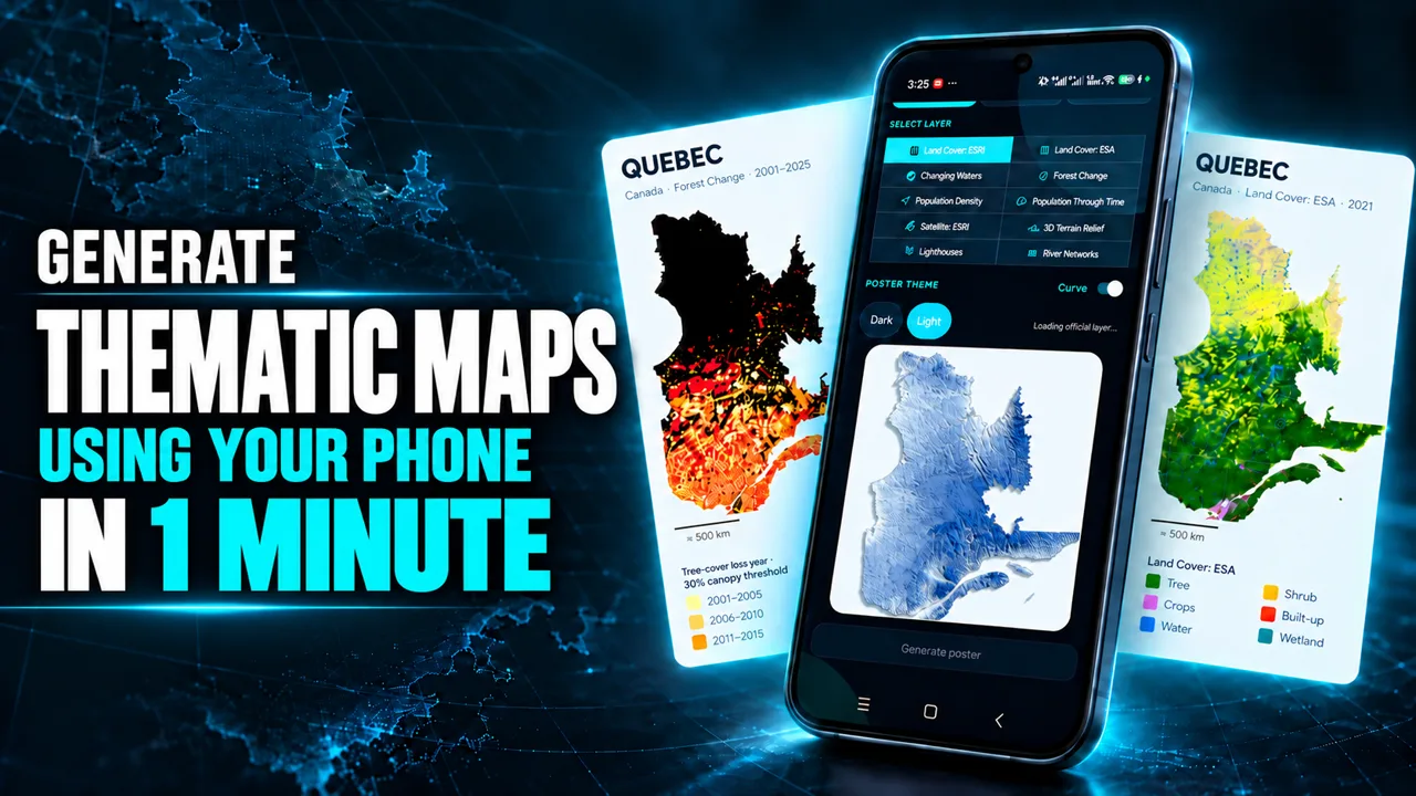
Create Your Own Thematic Maps Directly on Your Phone
Learning geography becomes more useful when you can also create something from the information you are exploring. EQUAL EARTH includes map-making capabilities designed for mobile use.
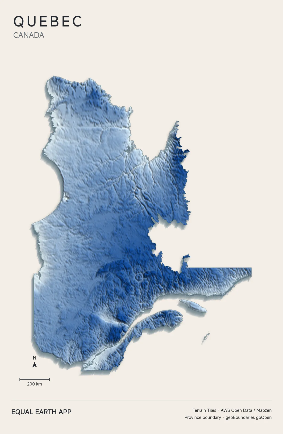
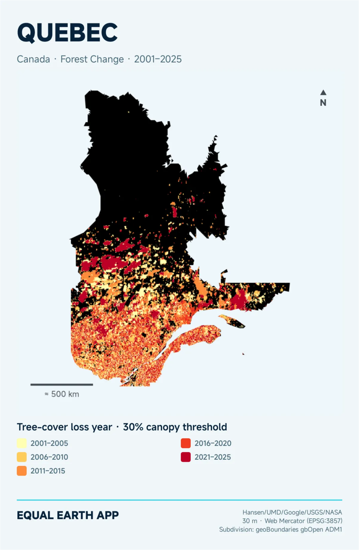
You can create thematic maps for a country, province, state, or study area and turn geographic datasets into maps for learning, presentations, research, or exploration.
- Land cover
- Satellite imagery
- 3D relief and terrain
- River networks
- Population
- Environmental layers
A land-cover map tells one story. A relief map tells another. Satellite imagery gives another perspective. Together, they help build a richer understanding of a location.
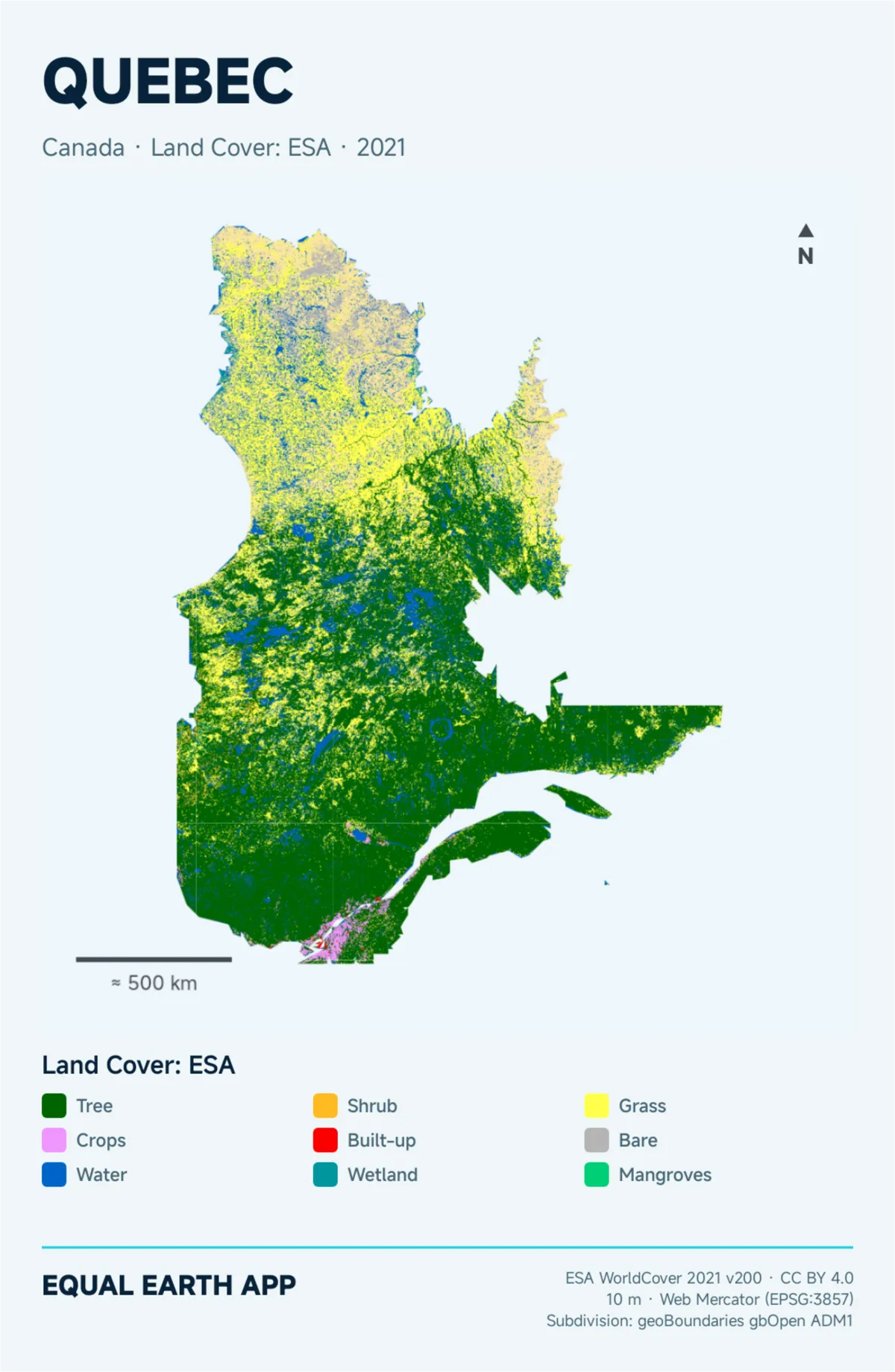
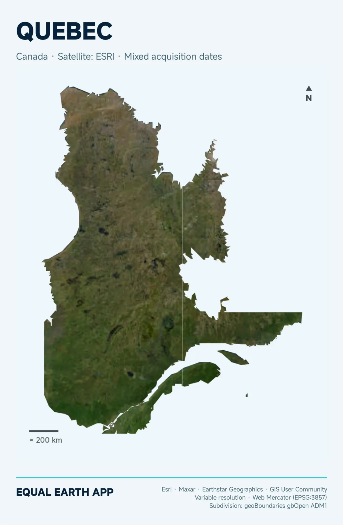
Watch: Map Your Own Country & Explore Earth from Space
See the app's map-making and Earth-observation features in action. Your phone can be more than a place to view a map. It can also become a tool for creating and exploring geographic information.
05
Explore Earth from Space with Sentinel-2
Maps help us understand how geographic information has been organized and represented. Satellite imagery lets us observe the physical surface of Earth itself.
The Satellite section of EQUAL EARTH introduces users to Earth observation through recent Copernicus Sentinel-2 imagery. Users can explore different ways of visualizing multispectral satellite data.
RGB / Natural Color
A view similar to how we normally see Earth's surface, useful for identifying cities, forests, farms, coastlines, and water.
False Color
Satellite bands are combined differently so vegetation and other surface features become easier to distinguish.
NDVI
The Normalized Difference Vegetation Index uses red and near-infrared information to highlight vegetation response.
MNDWI
The Modified Normalized Difference Water Index helps highlight water features and separate them from surrounding land.
These views introduce a fundamental remote-sensing idea: satellites can measure information beyond what our eyes see in an ordinary photograph.
From Satellite Image to Map
Viewing satellite imagery is useful. Turning it into information that can be communicated is even more useful.
EQUAL EARTH can turn satellite views into polished map outputs containing acquisition date, legend, scale bar, north arrow, map coordinates, and geographic context. You are not only looking at an image from space. You are learning how that image can become a map.
Explore Places Around the World
The Explore section moves from the global scale to individual places. Users can search for countries, cities, landmarks, addresses, and geographic coordinates. You can view your GPS position, select locations from the map, save places, and explore routes.
Planet → Country → City → Place → Your Position
Discover What Is Around You
Geography is also about access. The Nearby and Equal Access tools use geographic information to help users explore useful places surrounding their location.
- Cafés, groceries, and markets
- Hospitals, clinics, and pharmacies
- Transportation
- Parks and open spaces
- Schools, banks, and everyday services
06
A Pocket Geospatial Toolkit
EQUAL EARTH brings practical location and mapping tools together in one mobile app.
- Compass
- GPS Camera
- Altitude
- Speedometer
- Coordinates
- Saved Places
- Measure Area
- Measure Distance
- Share Location
- Map export
- Field validation
- Travel mapping
A student can learn coordinates and then read their own coordinates. A traveler can explore a place and save it. A field user can document a location. The smartphone becomes both a learning device and a geographic instrument.
Equal Earth for Students
For students, understanding maps should go beyond memorizing country names and capitals. Maps influence the way we interpret the world.
- Why does Greenland appear so large on many familiar maps?
- Why does Antarctica look enormous on Mercator?
- What happens to distortion toward the poles?
- Which projection should we use when comparing areas?
- How can satellites identify vegetation and water?
- How do we turn geographic data into a thematic map?
These questions connect geography, mathematics, environmental science, Earth observation, technology, and cartography. Increasingly, they can be explored from a device already in a student's pocket.
Equal Earth for Researchers and Map Enthusiasts
EQUAL EARTH is designed to remain approachable, but its concepts are also relevant to researchers, planners, environmental professionals, GIS users, architects, travelers, and people who simply enjoy maps.
The intention is not to replace professional GIS or remote-sensing software. Instead, it provides a more approachable way to explore geographic ideas anywhere.
Why Equal Earth Matters
A map is not simply a picture of Earth. Every world map makes decisions about how the planet's curved surface will be represented on a flat screen. Understanding those decisions is part of geographic literacy.
Equal Earth gives us an opportunity to ask better questions: What is being preserved? What is being distorted? How does projection affect the way we perceive different parts of the world?
When we stop treating the world map as something fixed and start exploring how it was made, Equal Earth becomes more than a projection. It becomes a way to learn how maps shape our view of the planet.
LEARN EQUAL EARTH ANYWHERE
See the world differently. See the world equally.
Explore projections. Compare countries. Create maps. View Earth from space. Discover what is around you. Learn how geography connects everything from a global world map to the coordinates beneath your feet.
07
Frequently Asked Questions About Equal Earth
What is the Equal Earth map projection?
Equal Earth is an equal-area world map projection. It is designed so geographic regions maintain their correct relative areas when represented on a flat world map.
What is the difference between Equal Earth and Mercator?
Equal Earth preserves relative area. Mercator instead preserves local angles and shapes, which makes it useful for certain navigation and mapping purposes, but areas become increasingly exaggerated toward the poles when the projection is used for a world map.
Why is Equal Earth useful for education?
It provides a useful way to teach students that every map projection involves trade-offs. Comparing Equal Earth and Mercator makes differences in area distortion easier to understand visually.
Can I learn Equal Earth using a phone?
Yes. EQUAL EARTH: Maps & Satellite by LINYA Labs is designed to make map projections, geography, satellite imagery, thematic mapping, and geospatial tools accessible from a smartphone.
Can I create maps using the Equal Earth app?
Yes. EQUAL EARTH includes tools for creating thematic maps using geographic layers such as land cover, satellite imagery, relief, rivers, population, and other available datasets.
Can I view satellite imagery in EQUAL EARTH?
Yes. The Satellite section includes recent Copernicus Sentinel-2 imagery and visualization options including RGB, False Color, NDVI, and MNDWI.
Is EQUAL EARTH only for GIS professionals?
No. The app is designed for students, educators, travelers, researchers, map enthusiasts, field users, and anyone curious about geography. You do not need professional GIS experience to start exploring.